August 3, 2026
Between modern media, books, and family travel, young children are exposed to a vast amount of language about our planet. They might hear phrases like “going around the world,” “on the other side of the world,” or see a flight path on a screen when traveling through the airport.
While young children absorb these phrases effortlessly, they still require concrete experiences to help them truly make sense of what "the world" actually means.
Over a century ago, Dr. Maria Montessori observed that the youngest children in her environments were deeply drawn to the globes the older children were using. Through careful observation, she realized that children crave a tangible, tactile understanding of abstract concepts like the Earth and the globe.
At OakHaven, we satisfy this curiosity by placing the world directly into the child's hands.
From Sandpaper to Continents: The Concrete Geography Materials
In an AMI-aligned environment, we don't start with abstract paper maps. We begin with three-dimensional, sensorial experiences so children can physically grasp the shape and texture of our planet.
- The Sandpaper Globe: This is a child's very first introduction to the Earth. The land surfaces are covered in textured sandpaper, while the water surfaces are smooth blue paint. A child runs their fingers across it, literally feeling the boundaries where oceans meet the continents.
- The Continent Globe: Once the distinction between land and water is clear, we introduce a second globe where the land is painted in vibrant colors to represent the seven continents. This color coding remains beautifully consistent across all Montessori materials (for instance, North America is always orange, Africa is green, and Europe is red), supporting visual association and deep retention.
- Land and Water Forms: To explore geography in three dimensions, children use three-dimensional molds to pour real water into models of an island, a lake, a peninsula, or a gulf. As they watch the water flow and settle around the brown landforms, the terminology moves from a vocabulary word to a lived experience.
Unfolding the World: The Puzzle Maps
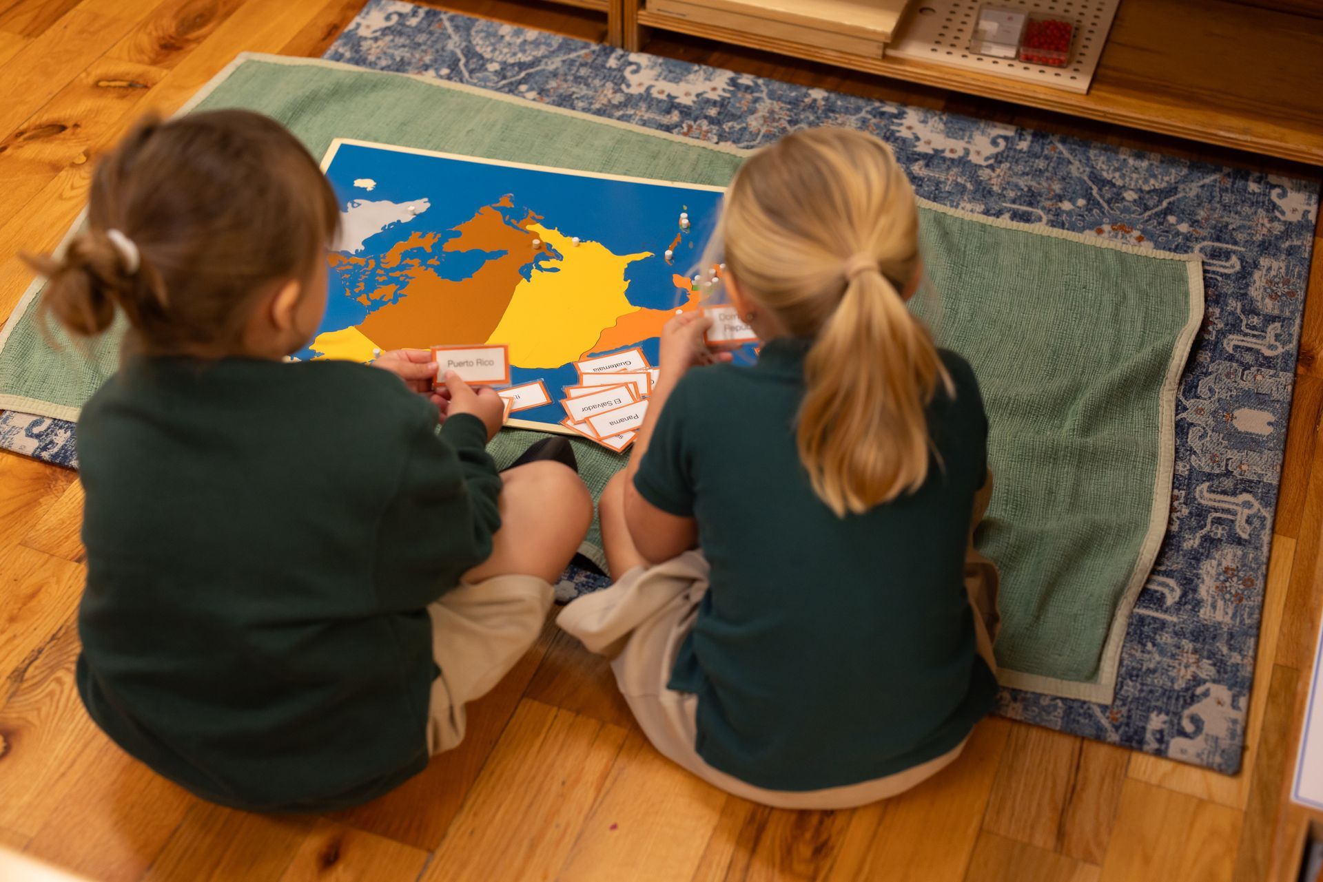
Once a child has a firm grasp of the round globe, we introduce the flat Puzzle Maps, which are divided into hemispheres. This transition allows the child to see all the continents simultaneously in a two-dimensional format.
As they progress through our Primary and Lower Elementary environments, they work with individual continent maps showing the political borders of countries. Each puzzle piece is a country, and the small knob used to lift the piece is precisely located at the nation's capital.
Initially, children engage with these maps in a purely sensorial way—taking them apart, feeling the wooden contours, and fitting them back together like a complex puzzle. As they work, Guides (teachers) gently introduce the names of the countries. Young children absorb this rich vocabulary with immense joy. It is not uncommon to see an older child close their eyes, trace the wooden edge of a puzzle piece with their fingertips, and correctly identify the country by touch alone.
Cultivating an Appreciation for the Oneness of Humanity
While it is certainly impressive when a young child can name dozens of countries, our purpose at OakHaven is not to turn children into walking encyclopedias. These intellectual skills are simply a beautiful byproduct of their natural curiosity.
Our deeper goal—aligned with our commitment to "Education for Life"—is to help children understand their unique place in the universe, foster an awareness of the oneness of humanity, and build a profound appreciation for the rich diversity of human culture.
To support this cosmic perspective, our environments feature beautifully curated folders of cultural photographs organized by continent. These images offer beautiful impressions of modern daily life, housing, regional food, transportation, textiles, and traditions from around the globe. They highlight a fundamental Montessori concept: that while all humans share the exact same fundamental needs, we have created wonderfully diverse and creative ways to meet those needs based on our geography.
A Lifelong Relationship with Our Planet
As our students develop a relationship with the world, their exploration naturally expands. They begin creating their own maps—carefully tracing the wooden puzzle pieces, shading the continents with colored pencils, and labeling the countries with beautiful cursive script.
Through this self-directed discovery, geography transforms from a subject to be memorized into a lifelong love for our planet and a deep respect for the global community that shares it.
If you would like to see how our beautiful environments foster this deep connection to the world, we invite you to connect with us.
Explore OakHaven: We partner with families throughout Dardenne Prairie, O'Fallon, and St. Charles County to provide an authentic, individualized education. When you are ready, we welcome you to
schedule a tour to experience our community firsthand.